
Back in the 1960s, Doctor Who introduced the Cybermen as coming from a “counter-Earth” called Mondas, a twin planet of our own that had escaped detection as it orbited the sun exactly opposite the Earth. Mondas was flung into deep space when the arrival of Earth’s moon disrupted the balance between the planets, and the inhabitants gradually surgically altered themselves to survive the increasingly harsh environment, until they were cold, cybernetic monstrosities who strapped enormous engines to their world, intent on returning to their home star and draining Earth of its precious energy reserves. Mondas itself was depicted as being exactly identical to Earth (except upside-down1While upside-down, it is still rotating in the conventional way, suggesting that the Mondasians also consider “north” to be “up” on their maps. I’m not sure whether that means that, spatially, the planet was upside down relative to Earth and rotating in the same direction, or the surface was aligned the same way but was rotating backwards, like Venus . I doubt anyone gave it that much thought.), complete with humans identical to those on Earth.
There is no prize for finding the most scientific inaccuracies in that paragraph.
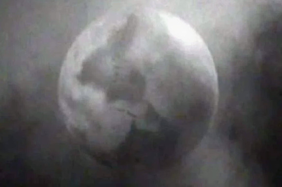 “World Enough and Time” and “The Doctor Falls,” the two-part season 10 finale of Doctor Who, revisited the Cybermen’s origin. While set on a ship either constructed by or commissioned for the people of Mondas rather than the planet itself, we do see a computer screen showing a display of the planet. At a casual glance, Mondas still appears to be identical to Earth (though right-side up this time2And still rotating in the conventional direction. Maybe they reversed the planet’s rotation when they attached the engines, like that episode of Futurama.), but the Doctor Who art department took the time to subtly modify the layout of the continents as a freeze-frame bonus. I’d hoped that the BBC’s Production Art gallery for the episode might contain a complete map, but, alas, it is not to be, and it seems unlikely the show will be revisiting Mondas anytime soon, leaving reverse-engineering the planet to fans like me.
First, I had to correct for the prespective distortion of the computer screen, so here’s the straight-on view of Mondas, in both Quicktime and GIF formats.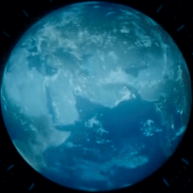
I then unwrapped it using badass 3D modeling techniques to get an equirectangular projection map. Here is the resulting map with one of those sliders I like so much comparing it to the Earth (I gave the Earth a similar color-cast as the computer display of Mondas, so the comparison is easier on the eyes).
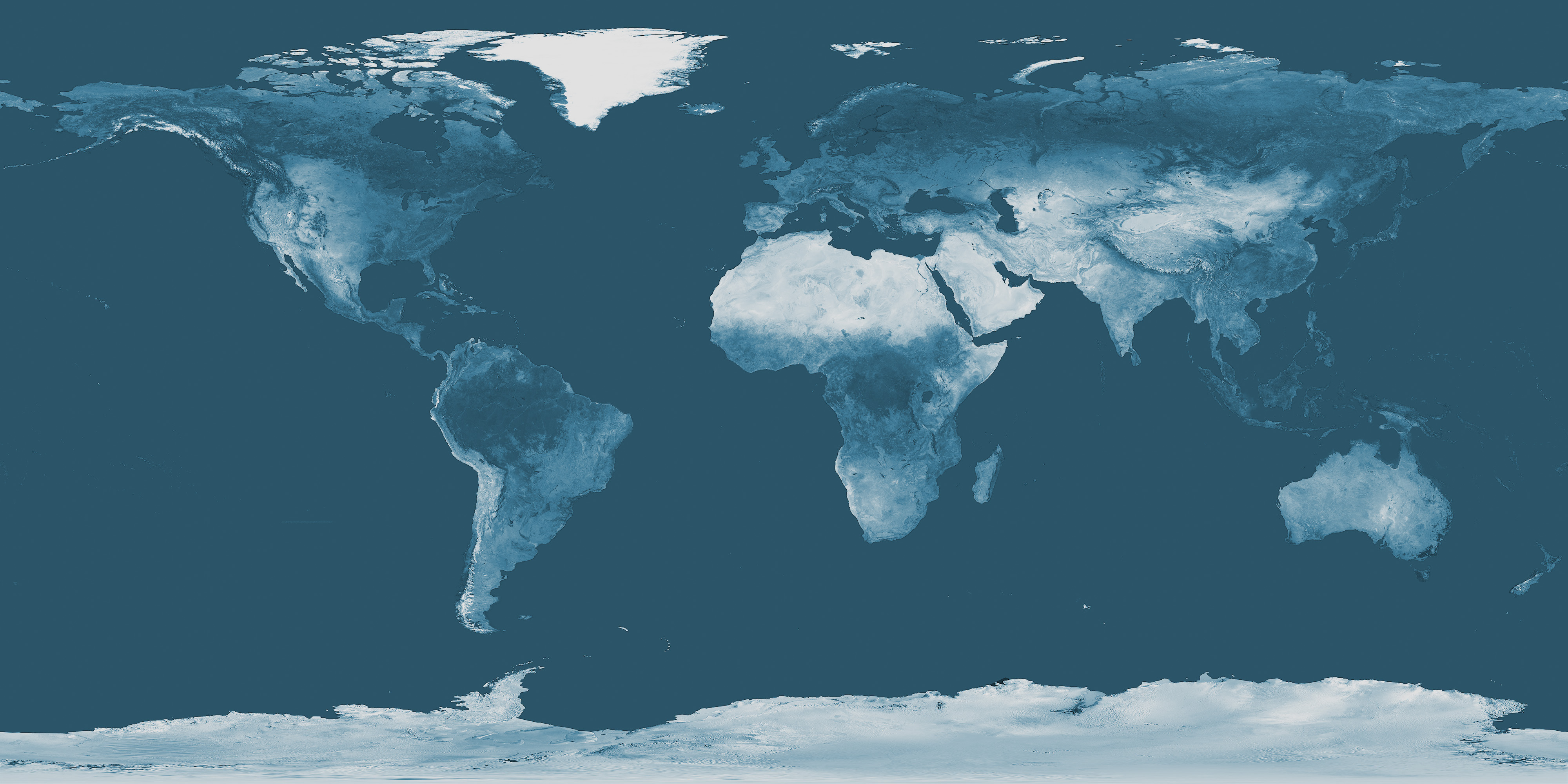
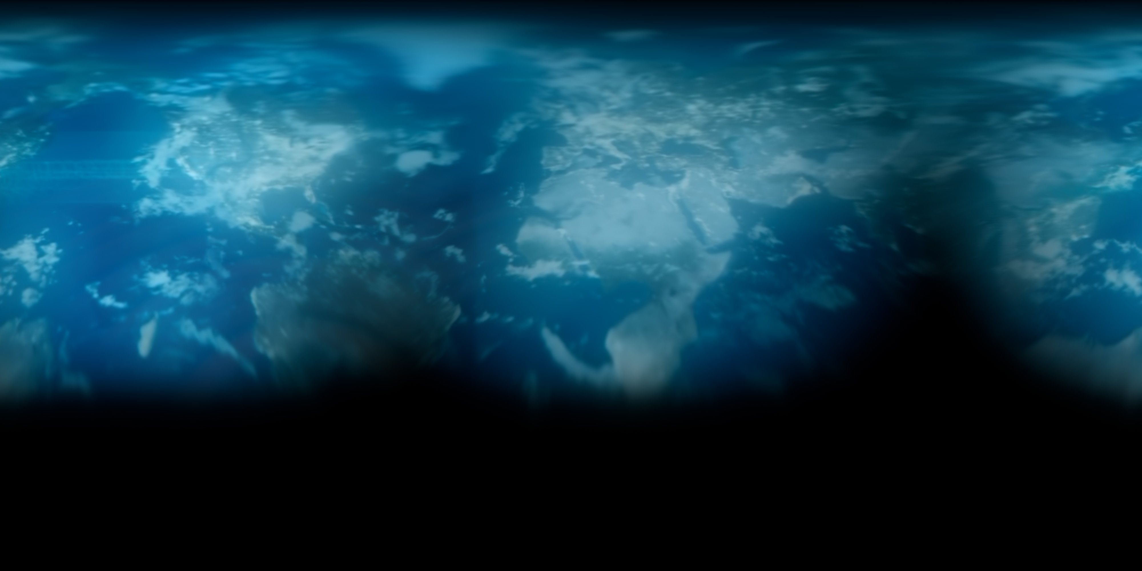
If you want a better look, here’s Mondas by itself. Click to cyber-enhance:
Here’s a brief listing of the differences I can see. Some are admittedly tricky because of the clouds, and the southernmost quarter of the planet, as well as central Asia and Indonesia are pretty much a total mystery, but what is there is intriguing. I have very little understanding of plate tectonics and continental formation, so I can’t tell you if this is a plausible alternative arrangement of the Earth’s surface, or if it’s just something that was meant to look a bit different from what we’re used to. There’s one difference in particular that seems like it could have a solid foundation in reality, and one in particular that just seems like a quick change in Photoshop.
Starting at the International Date Line and working our way east…
The Seward Peninsula in Alaska is removed. Hudson Bay has been moved west, and the islands north of it have been moved southwest, possibly separating Alaska from the North American mainland. There’s a very wide river, possibly a strait, snaking from Hudson Bay down to San Diego. Madagascar has been somewhat inexplicably moved from the southeast corner of Africa to the middle of the south Pacific (that’s the change that just seemed like quick-and-dirty Photoshopping). The Baja Peninsula has been either removed or turned into an archipelago (I can’t tell if those are clouds). Judging by the shape of the new coastline, Indian subcontinent has been moved from the south of Asia to the north-west corner of South America (that’s the one that makes me think some amount of geological research went into this. I especially like Asia’s southern coastline following where the Himalayan mountains are on Earth, since that mountain range is a result of the two continental plates colliding).
Europe appears to be untouched.
Africa has a massive gulf in the middle of its west coast, extending into the DRC and stopping just short of Lake Victoria, as well as a lengthy strait cutting the continent in two from the western Sahara region down to the western border of Nigeria. It does not seem to have any additional fjords, likely because they would not be sufficiently equatorial.
The Persian Gulf is much larger, opening into a wide, triangular feature that seems to take up Earth’s UAE, Oman, and the southeast corner of Saudi Arabia. The Black Sea and the Caspian Sea are connected. As mentioned above, India is not in its familiar location, and there seems to be a large lake just north of where India would be on Earth.
There’s a ton of distortion, so it’s hard to see what’s going on with eastern Asia, but it looks like it’s been pretty heavily reconfigured and moved a good distance to the southeast, and Australia, while also out of view, seems to be more than double the size, and also further west than you’d expect. It’s possible this is an error on my part marrying the two shots, but Greenland and the clouds in the north Atlantic were visible enough to align them, and the other sizing matched up, so I think that’s accurate. It’s probably just the case that since we don’t see some sections of the globe, I’m missing the last bits of context needed to make sense of what the deal is with those areas. It’s also possible that all the seams were put there, and the on-screen graphic was intentionally created to avoid showing that part of the planet.
| ↑1 | While upside-down, it is still rotating in the conventional way, suggesting that the Mondasians also consider “north” to be “up” on their maps. I’m not sure whether that means that, spatially, the planet was upside down relative to Earth and rotating in the same direction, or the surface was aligned the same way but was rotating backwards, like Venus . I doubt anyone gave it that much thought. |
|---|---|
| ↑2 | And still rotating in the conventional direction. Maybe they reversed the planet’s rotation when they attached the engines, like that episode of Futurama. |